

iFires
Integrated Targeting System
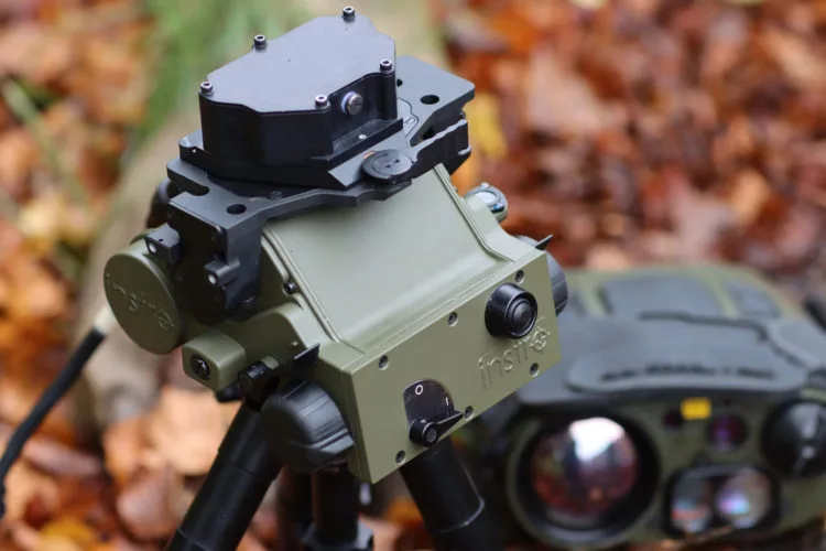
iFires is a highly advanced Integrated Targeting system, providing a modular open architecture targeting solution which can be integrated by Instro with any contemporary electro-optic target locator.
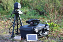
The iFires system consists of a number of interoperable modules designed to extend the capability of the chosen sensor, while providing significant advantage to the operator.
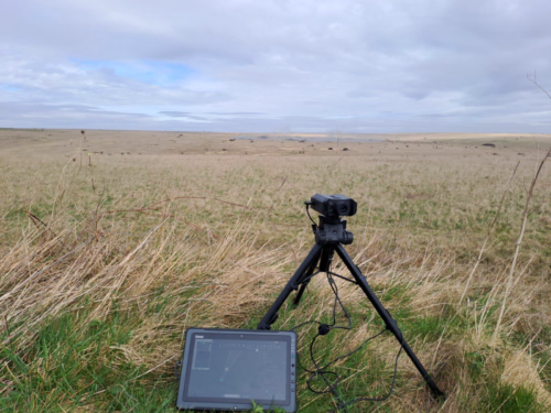
System flexibility means the user can make tailored selections from their equipment, configuring differently to each individual need. Be it basic handheld use, or long-range target acquisition, requiring accurate north referencing and precise angular measurements.
As an aid to situational awareness, iFires features a streamlined mapping capability accessible from all operational screens. This capability provides the operator with a useful visual overview of acquired targets with respect to the observers position.
The iFires targeting computer comes installed with Instro’s Targeting App.
Main Advantages & Features
- Integration with leading electro-optic sensors
- Targeting computer with comprehensive target acquisition software, including streamlined digital mapping capability for enhanced situational awareness
- Lightweight man portable package with low power consumption, high accuracy precision goniometer unit and lightweight tripod
- Accurate north reference capability via dedicated accessory modules
- Line of sight fine adjust control
- Reversionary mechanical scales
- Digital magnetic compass compatible
Features and Benefits
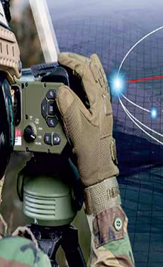
Compatible for all joint fires observer tasks
Streamlined digital mapping for enhanced situational awareness
Simple integration with the leading EO sensors
- iFires is suitable for all Joint Fires observer tasks
| Specifications | |
|---|---|
| WEIGHT | Goniometer - 2.5kg | Targeting Computer - 0.54kg | Tripod – 1.1kg to 2.72kg |
| GONIOMETER DIMENSIONS | 178mm (D) x 173mm (W) x 124mm (H) |
| TARGETING COMPUTER DIMENSIONS | 18mm (D) x 202.7mm (W) x 132mm (H) |
| OWN POSITION LOCATION BY | GPS | Resection | Manual Entry |
| NORTH ORIENTATION BY | Known point | Celestial alignment | solar compass | gyro compass | digital compass | manual entry |
- Digital interface for leading EO sensors
- Cable or Cable-less EO sensor interfacing
- Customer specific grid
- Power distribution unit with system cable

How can we help?